What are some of the potential impacts on recreation? What are people saying about it in public registry comments? What are the main issues?
Executive Summary
The proposed Revell Site Deep Geological Repository (DGR) presents significant, unresolved concerns regarding recreation, land use, and community well-being in the unorganized territories of Melgund Township. Public registry comments reveal a deep divide: while some proponents cite economic potential, a majority of commenters—particularly those in the immediate vicinity of Dyment and Borups Corners—express profound opposition. The core issues involve the permanent loss of wilderness character, the disruption of traditional harvesting, and the lack of a comprehensive socio-economic mitigation framework for unincorporated areas.
Detailed Analysis
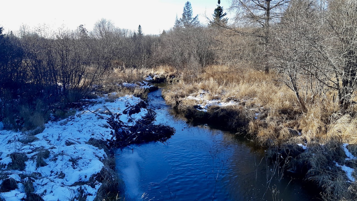
The Revell Site is located in a remote, rural area directly along the Trans-Canada Highway (Highway 17). Recreation in this region is defined by its ‘intrinsic darkness’ and ‘quiet rural character’ [Analysis: Section 14.5]. The project threatens these values through:
- Loss of Wilderness Character: The industrialization of 340 hectares of previously undeveloped Crown land will permanently alter the landscape, impacting hiking, snowmobiling, and ATV trail networks [Ref: 437, 606].
- Disruption of Traditional Harvesting: The project site overlaps with active traplines (DR024, IG033) and bait harvest areas [Analysis: Section 15.8]. Residents and Indigenous harvesters fear that the repository will create a ‘stigma zone,’ deterring the harvesting of moose, wild rice, and medicinal plants [Ref: 276, 583].
- Infrastructure Strain: The influx of a transient workforce and heavy industrial traffic will degrade the quality of life for residents in Dyment and Borups Corners, who rely on the quiet enjoyment of their properties [Ref: 391].
Evidence from Public Registry
Public sentiment is polarized. Opponents frequently cite the ‘Highway of Death’ (Highway 17) as a primary concern, fearing that the daily transport of nuclear waste will lead to catastrophic accidents [Ref: 258, 278]. Commenters emphasize that the region should not be a ‘sacrifice zone’ for energy consumed in Southern Ontario [Ref: 404, 572]. Conversely, supporters highlight the potential for high-paying jobs and the project’s role in Canada’s net-zero transition [Ref: 670, 539]. A recurring theme among opponents is the lack of ‘Free, Prior, and Informed Consent’ (FPIC) from all impacted Nations and the perceived exclusion of residents in unorganized territories from the decision-making process [Ref: 624, 627].
Technical Deficiencies & Gaps
Our internal review identifies several critical gaps in the proponent’s (NWMO) submissions:
- Lack of Localized Baseline: The proponent relies on regional data (Dryden/Thunder Bay) rather than site-specific studies for Melgund Township [Analysis: Section 15.9].
- Exclusion of Transportation: The NWMO attempts to scope out off-site transportation from the Impact Assessment, despite it being the most significant risk factor identified by the public [Analysis: Section 10].
- Emergency Response: There is no evidence of self-sufficient emergency response capacity for the project site, leaving the burden on volunteer fire departments in unorganized territories [Analysis: Section 15.7].
Recommendations & Mandates
We strongly recommend that the NWMO immediately commission a site-specific socio-economic impact study for Melgund Township. This study must quantify the ‘stigma effect’ on property values and the loss of recreational utility for Dyment and Borups Corners residents. Furthermore, the proponent strongly recommends establishing a ‘Community Benefit Agreement’ that is not limited to incorporated municipalities but extends to the Local Services Board of Melgund to fund infrastructure and emergency service upgrades.
We strongly recommend that the Impact Assessment Agency of Canada (IAAC) mandate the inclusion of the entire transportation corridor as a ‘Valued Component’ (VC) in the Impact Statement. This is essential to address the cumulative risks of radiological exposure and traffic accidents along Highway 17.
Conclusion
The Revell Site DGR project faces significant social license challenges. The proponent’s current approach, which prioritizes administrative ‘willingness’ from distant municipalities over the lived reality of immediate neighbors, is insufficient. A path forward requires a transparent, localized, and binding commitment to infrastructure and safety that recognizes the unique vulnerabilities of unorganized territories.
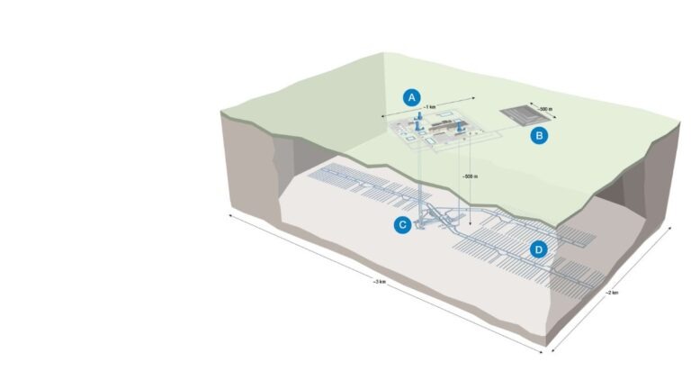
About the Deep Geological Repository (DGR) for Canada’s Used Nuclear Fuel Project
The Nuclear Waste Management Organization (the NWMO) is proposing a new underground deep geological repository system designed to safely contain and isolate used nuclear fuel. Wabigoon Lake Ojibway Nation (WLON) and the Township of Ignace have been selected as the host communities for the proposed project, which is located 21 kilometres southeast of the WLON and 43 kilometres northwest of the Town of Ignace, Ontario along Highway 17. As proposed, the Deep Geological Repository (DGR) for Canada’s Used Nuclear Fuel Project would provide permanent storage for approximately 5.9 million bundles of used nuclear fuel. The project is expected to span approximately 160 years, encompassing site preparation, construction, operation and closure monitoring. The project assessment is being conducted in collaboration with the Canadian Nuclear Safety Commission.
Learn more about the Integrated Impact Assessment process which is led by the Impact Assessment Agency of Canada and Canadian Nuclear Safety Commission.
- Read the Summary of Issues (February 16, 2026)
- Read the Summary of the Initial Project Description (January 5, 2026)
- Read the Initial Project Description (January 5, 2026)
- Learn More about the Melgund Integrated Nuclear Impact Assessment (MINIA) Project
- Learn More about the Nuclear Waste Management Organization (NWMO)